Exploring geography has never been more engaging and hands-on than with Montessori pin maps. Initially developed by Dr. Maria Montessori, a renowned Italian physician, educator, and innovator who believed in experiential learning, these maps provide an excellent learning experience for children that blends tactile input and a visual understanding of geography.
Introducing Montessori Philosophy
The Montessori method emphasizes the importance of respecting each child as an individual, fostering independence, and nurturing their innate love for learning. This approach is grounded in the belief that children learn best through hands-on experiences, encouraging self-discovery, exploration, and experimentation.
Key Principles of the Montessori Method
- Mixed-age classrooms: Children interact with peers from different age groups, enriching their learning experiences as they collaborate and form relationships across generations.
- Prepared environment: Teachers create spaces filled with materials designed to entice curiosity, inspire creativity, and promote exploration among their students.
- Uninterrupted work periods: Students have ample time to delve deeply into the subjects and activities that interest them most, leading to enhanced concentration, knowledge retention, and intrinsic motivation.
- The adult as a guide: The teacher’s role is not to impart knowledge but to serve as a knowledgeable guide, facilitating learning and setting up authentic opportunities for discovery.
- Learning through doing: Instead of being passive recipients of information, students actively participate in hands-on activities and experiments that capture their interests and foster knowledge acquisition.
In line with these core values, Montessori pin maps facilitate geographic education, providing children with an interactive and engaging way to familiarize themselves with different continents, countries, and land formations.
Montessori Pin Maps: Invaluable Tools for Geographic Learning

A hallmark of Montessori learning materials, pin maps are crafted using a wooden base that features the outline of the continent or country under study. These maps come in varying sizes, scaled representations of different regions such as the seven continents or individual countries.
-
Fostering Spatial Awareness
By working with pin maps, children gain a sense of the world’s scale, location, and physical relationships between continents and countries. They learn about prominent features like bodies of water, borders, capitals, and other landmarks through hands-on manipulation and exploration.
-
Cultivating Fine Motor Skills
Pin maps offer an excellent opportunity for young learners to hone their fine motor skills. The accompanying pins encourage them to practice precision, hand-eye coordination, and dexterity, which are essential developmental milestones at this age. Moreover, these physical components help kids strengthen their grip and develop concentration as they navigate geographical locations.
Varying Levels of Complexity
One of the most compelling aspects of Montessori pin maps is their adaptability to cater to different levels of knowledge, skill, and engagement. This scalability allows educators and parents alike to provide age-appropriate challenges to children, fostering growth, and continuous learning throughout their academic journey.
-
Simple Map Components
For the youngest students, maps with fewer elements can be introduced, such as those featuring only large land formations (e.g., continents) or countries without any cities or capitals. This type of map serves as an excellent introduction to geography and spatial awareness.
-
Advanced Map Elements
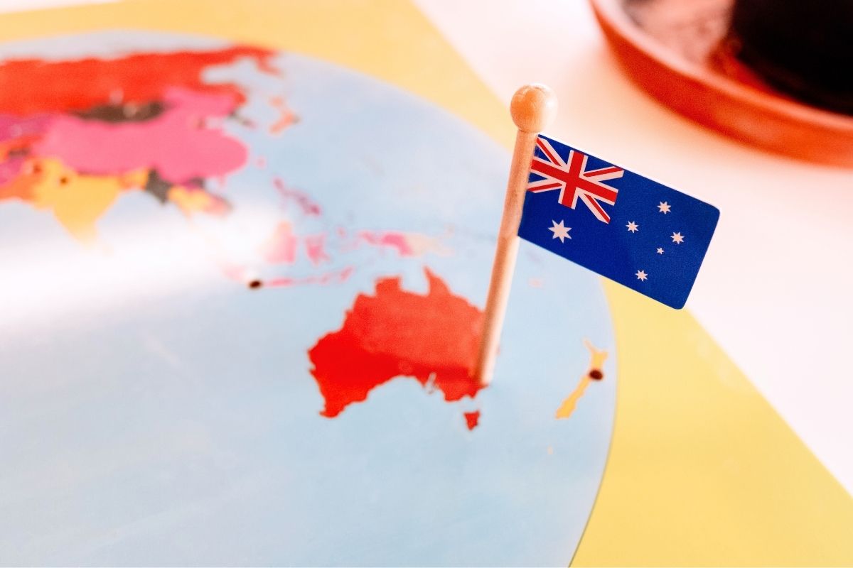
As children grow in their understanding of the subject, they can progress to more advanced maps that include details such as capital cities, major landmarks, and rivers. Additionally, elements like flags or cultural symbols can be added to contribute to comprehensive learning about different nations, cultures, and geography lessons.
Montessori Pin Maps: Options and Applications
There is a myriad of ways in which pin maps can be utilized in the classroom or at home to engage children in geographic exploration. Some popular options include:
- World maps: Depicting all seven continents, these comprehensive maps offer a global perspective, allowing children to understand the relationship between various land formations and countries.
- Continent maps: Focusing on specific continents allows for more in-depth examination of different regions and their unique attributes.
- National maps: Individual countries can be studied in greater detail, with boundaries, capitals, and major cities being included in this type of map.
Beyond the pin maps, a typical Montessori geography setup comprises several essential elements:
- Sandpaper Globes: These are textured globes where land areas are raised. Young learners can run their hands over these globes, differentiating between land (rough) and water (smooth).
- Landform Models: These miniature models represent geographical formations like islands, lakes, peninsulas, and gulfs. They offer a 3D perspective, making abstract geographical concepts tangible.
- Puzzle Maps: Made of wood, these are divided by continents, countries, or states. Each piece represents a geographical entity, aiding in recognition and understanding.
- Continent Boxes: These boxes contain materials related to each continent, integrating cultural, ecological, and geographical learning.
Regardless of a child’s age or interests, Montessori pin maps and related materials enhance their geographic learning. Educators and parents can seamlessly integrate these tools into curricula and home settings. Montessori pin maps, paired with essential elements, strengthen students’ grasp of geography through sensory engagement and purposeful play. Interacting with these tools deepens children’s global understanding, fostering informed and appreciative global citizens.
Montessori Geography: Beyond Pin Maps
While the pin maps and their components form a crucial part of Montessori geography, the learning doesn’t stop there. The Montessori approach is all-encompassing.
- Physical Geography: Before diving into borders and nations, Montessori education introduces children to the Earth’s physical features. From majestic mountains and vast oceans to serene deserts and dense forests, children learn about the diverse landforms and water bodies that adorn our planet. This foundation ensures that as they move to more complex topics, they have a solid base to build upon.
- Cultural (or Political) Geography: Humans have always been wanderers and settlers, and as they settled, they formed communities, cities, and eventually, nations. Montessori’s cultural geography delves into this human aspect. Children learn about countries, their borders, the cultures that thrive within them, and the intricate dance of diplomacy and politics that binds them together. Through stories, artifacts, and discussions, they get a glimpse of the rich tapestry of human civilization.
DIY Montessori Push Pin Maps

Creating a DIY Montessori Pin Map is a rewarding project that combines geography with hands-on learning. It’s an engaging way to introduce children to world geography, allowing them to explore and understand the world in a tactile manner.
Materials
- Cork Boards or foam core board.
- Unlabeled maps of each continent (Free options available on geology.com and mapswire.com).
- Toothpicks or pins with different colored heads.
- Map Labels (Can be created or purchased).
- Colored pens or permanent markers.
- Atlas or online maps for reference.
Procedure
- Choose your desired maps and print them.
- Place the printed map on the cork board or foam core board.
- Mark major geographical points with colored dots (e.g., capitals with red dots, countries with black dots, and major waterways with blue dots).
- Cut and prepare labels, attaching them to toothpicks or pins.
- Use the atlas or online maps as a reference to accurately place the pins on the map.
- Store the pins in a container when not in use.